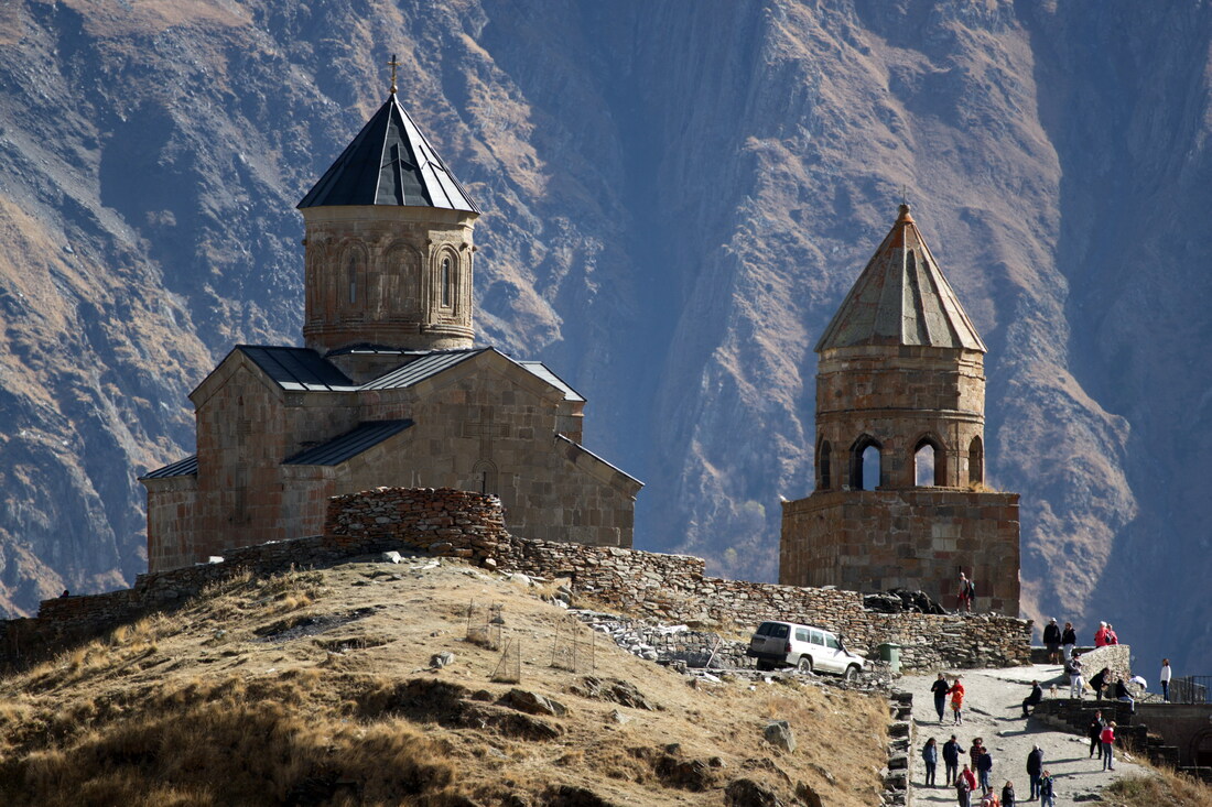
Gergeti Trinity Church
Producing a map was a bit of a challenge. This shows my route as accurately as I can from memory.
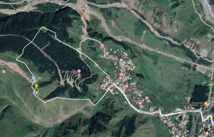
Elevation of the church2170m
|
Distance/Ascent3.5km 430m
|
Approximate time1h each way - The downhill route is steep so there is little difference in the uphill and downhill times. Of course, if done in reverse, the downhill time could be less.
|
23 October 2019
This was part of my first trip to Georgia. It is a beautiful country with a European feel. Interestingly, the internet speed at the guest house in Stepantsminda (Rustaveli st 11) was far faster than my home in the Highlands! Perhaps there is better investment in the infrastructure?
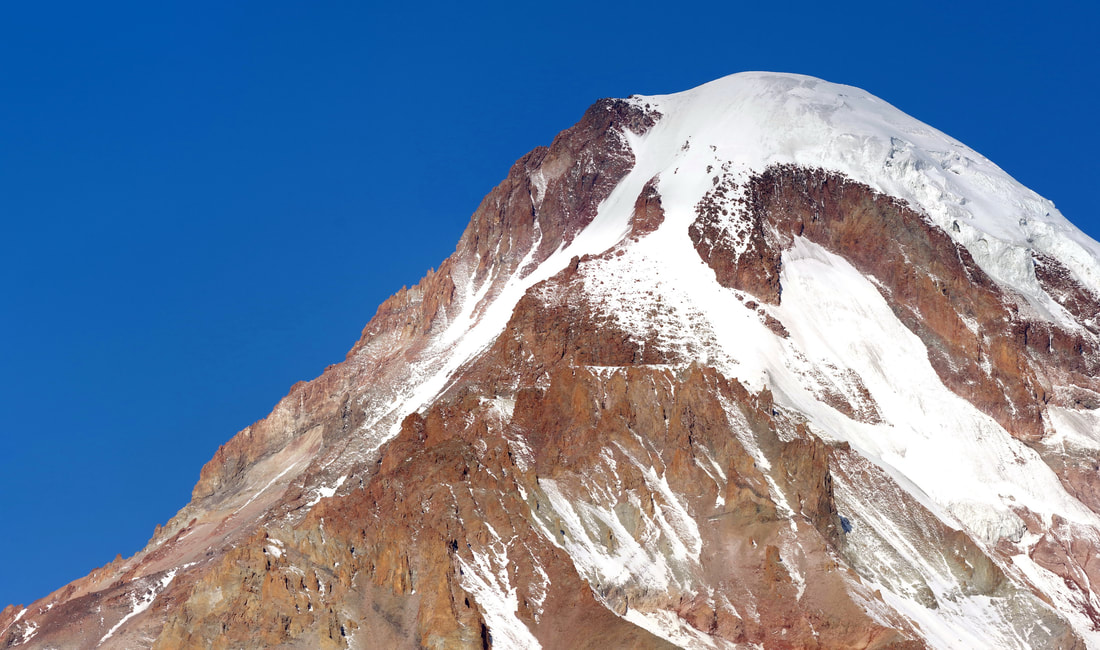
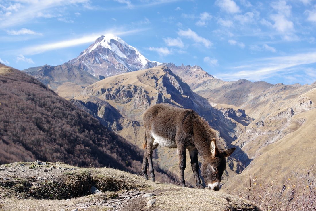
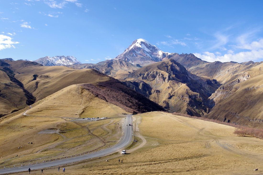
From the moment I arrived, my eye was drawn to Mount Kazbek (5033m). I know there was a time when I could have climbed it, but I am not sure that I could now!
Photo taken with a 300mm prime lens on a APS-C camera.
From the moment I arrived, my eye was drawn to Mount Kazbek (5033m). I know there was a time when I could have climbed it, but I am not sure that I could now!
Photo taken with a 300mm prime lens on a APS-C camera.
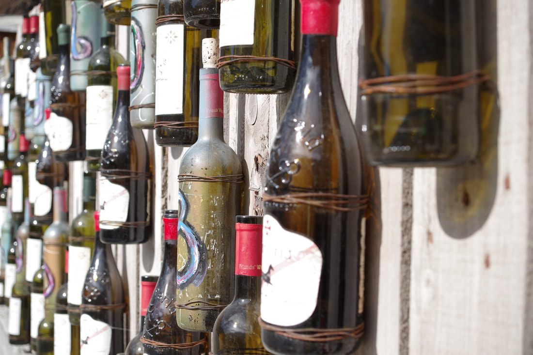
The route crosses the river and past the Restaurant Panorama with its ornate fence decorated with used wine bottles.
I had called into the visitor centre, where I chatted at length with the young girl who was working there for the summer and had stayed a bit longer. She was from a Russian occupied region of Georgia, and was unable to return to her home and family. She advised me not to approach the church by the path that crosses the new road as the road works made some parts difficult and unpleasant. I believe the road was in fact completed in 2018. The route I followed only crossed the road in two places and it was absolutely fine. I think her advice was a bit out of date.
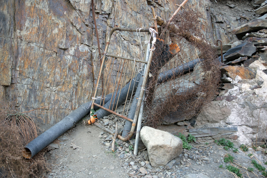
As I walked up to the upper edge of the village, I came to a T junction, though it was the end of the motorable road, both options being too narrow for cars to pass. It amused me how there was a parking sign. In the UK, there would be a NO PARKING sign! I headed left in search for access to the ridge that offered the most direct approach to the church. However, there did not seem to be easy access. I investigated further on my return to find that there was a small path but access would have been a bit of a squeeze.
As I walked up to the upper edge of the village, I came to a T junction, though it was the end of the motorable road, both options being too narrow for cars to pass. It amused me how there was a parking sign. In the UK, there would be a NO PARKING sign! I headed left in search for access to the ridge that offered the most direct approach to the church. However, there did not seem to be easy access. I investigated further on my return to find that there was a small path but access would have been a bit of a squeeze.
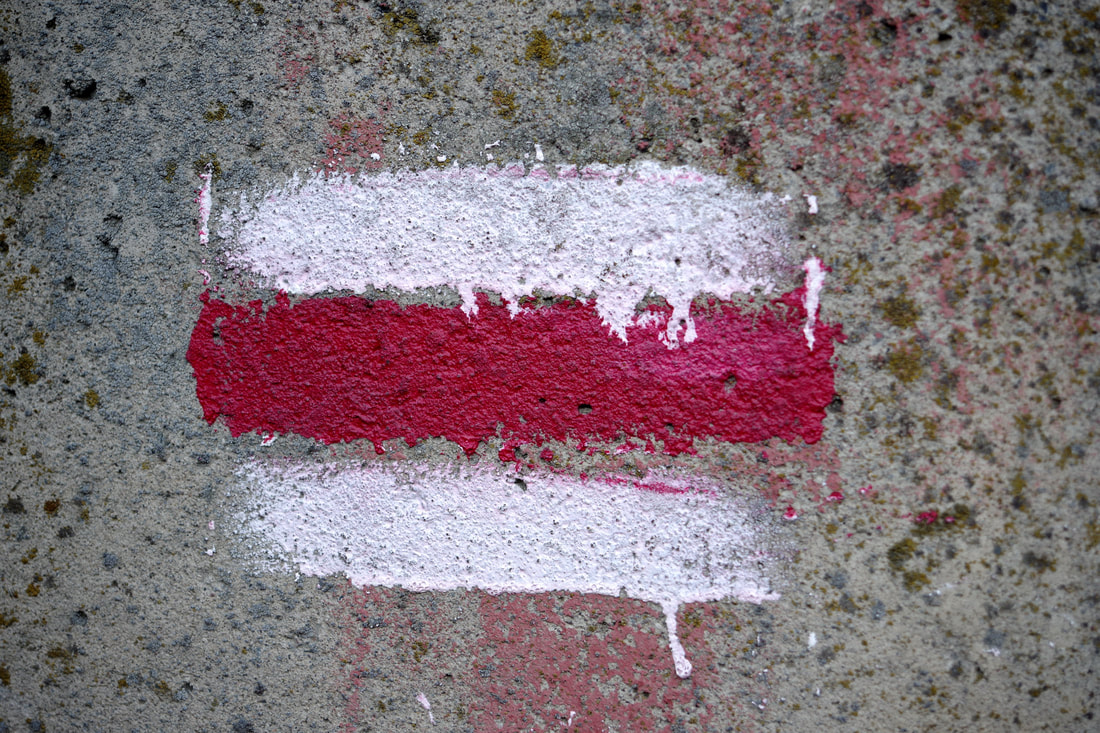
I strongly considered taking the big path/track to the left of the ridge, which, as it turned out, would have given me access to the ridge, provided I took the right hand fork. However, I kept right and started to pick up markers that were the Latvian flag in reverse - I mean the carmine red parts are white and vice versa.
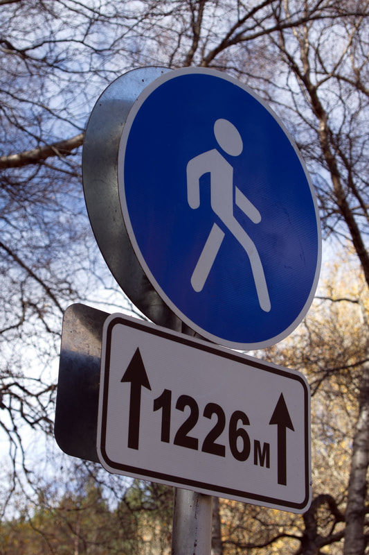
Later, these seemed to be replaced by these signs. As I passed each one, I was surprised by how much height I had gained....that is, until I realised it was the horizontal distance!
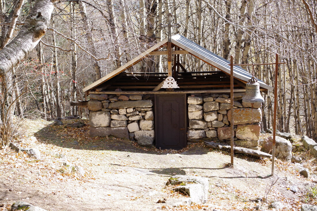
The well constructed path passed up through the trees. Combined with the time of year, it prevented overheating in the sun and it was extremely pleasant walking. The path lead up to this small chapel.
The path rises more steeply and after a couple of twists and turns, clears the treeline. The path is clear with constructed steps throughout.
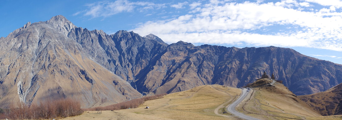
Once clear of the trees, the views bring joy to the heart of everyone who loves the mountains. Some may disapprove of the newly constructed road, but I think one road is far better than the multitude of dirt tracks that it replaces. Hopefully the old scars will slowly heal.
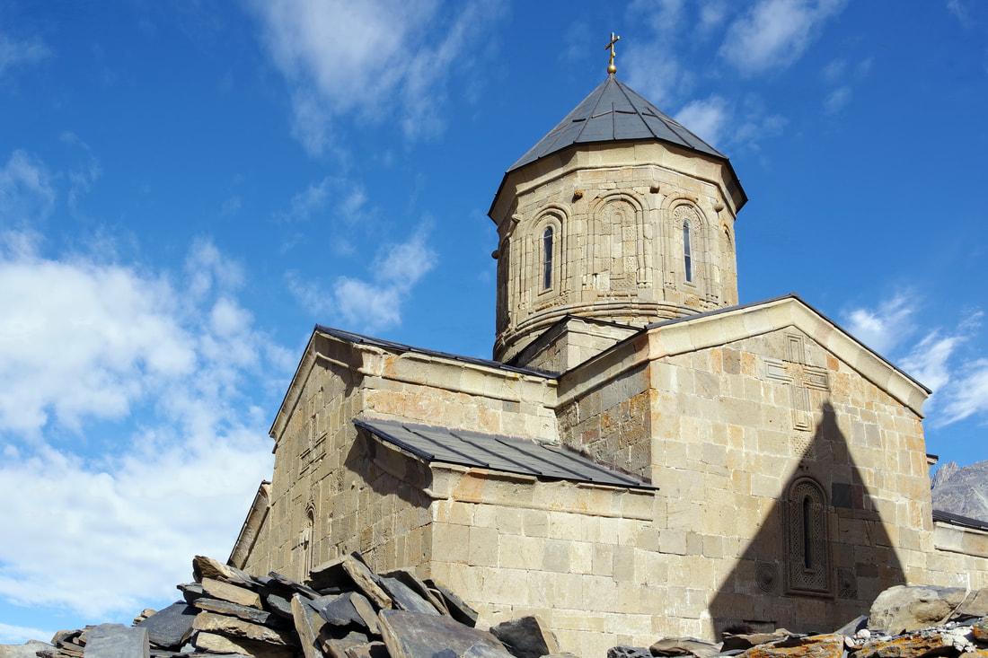
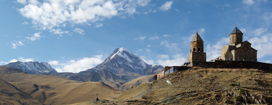
The Gergeti Trinity Church was built in the 14th century. The separate belltower dates from the same period as the church itself. Its isolated location on top of a steep mountain has made it a symbol for Georgia. Notice the Saint Nino crosses on he roof of the church.
I had really enjoyed the hike up the well-constructed path. It was so much easier underfoot that hiking up a pathless Corbett with boggy ground or deep heather. A good path makes things so much easier!
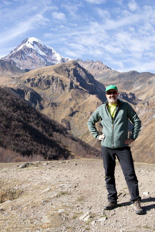
I chatted to a professional videographer and his model. She had stopped the sexy poses as I approached. The man kindly took my photograph for me with Mount Kazbek behind. Often when I ask people to take my photograph, I am disappointed with the results, usually just aiming the camera at my face and not considering the overall composition. I am very happy with this one though.
I chatted to a professional videographer and his model. She had stopped the sexy poses as I approached. The man kindly took my photograph for me with Mount Kazbek behind. Often when I ask people to take my photograph, I am disappointed with the results, usually just aiming the camera at my face and not considering the overall composition. I am very happy with this one though.
There was a very friendly jenny and her foal to add further interest to my photographs. Personally though, I think I made the better model! :)
I would like to come back and have a go at Mount Kazbek, or even a high camp on the ridge to the left!
It looks as though the church/monastery buildings have been renovated but they are still working on the surrounding paving and walls. This does mean that there are some restrictions on where you can wander. There are young men, perhaps novice monks, who stop people taking photographs inside the church. They do so politely, but firmly.
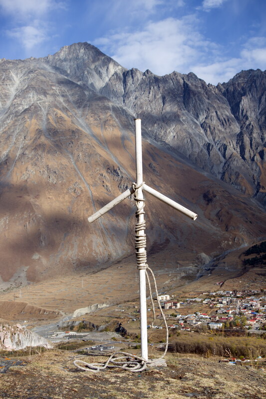
My route down passed another cross down a clear, but steep, stony path.
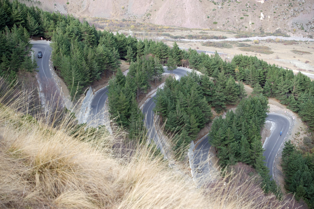
I know that roads are not natural, but there is a certain beauty in the way it snakes its way up through the forest.
Continuing down to a St Nino cross. The ridge continues to a very tatty Georgian flag, beyond which there is a steep drop. There is a choice of heading left across easy ground but this terminates at the blocked off section shown above. So after scrambling up to the flag, I descended down the south side. This required a little bit of care but not too difficult.
The route eventually led back to the upper parts of the village.
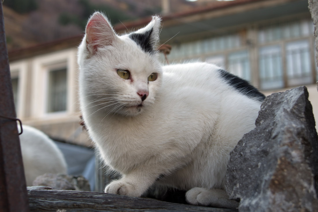
I am more of a dog person than a cat person but this cat portrait came out rather well!
I am more of a dog person than a cat person but this cat portrait came out rather well!
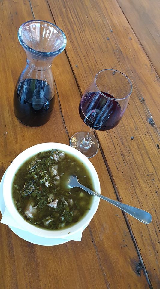
I stopped at the Restaurant Panorama for refreshments before returning to the guest house to edit the days photos.